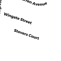
19 STOVER CT
Owner Information
DAY STEPHEN E
19 STOVER CT
AMESBURY, MA None


Property Details
19 STOVER CT is classified as a Single Family Residential (Modern/contemp).
The primary structure on this property was built in 1971. There are 3,214ft2 of built area within this property. There is 1,082ft2 of residential/living space within this property. This property is listed as having 7 rooms.
19 STOVER CT is valued at $356,600. The land is valued at $164,000 and the structures are valued at $188,300. There is an additional valuation of $4,300 on this property.
This property is in Zone R8. Confirm with local Zoning Board authorities to ensure there are no overlays or other easements on this property.
The most recent deed for 19 STOVER CT is recorded at the local registrar in Book 34637, Page 266. 19 STOVER CT was last sold on Tuesday, January 5, 2016 for $300,000.
Assessment data from fiscal year 2022.
Flood Data
According to the FEMA National Flood Hazard Layer, this property does not appear to be in a flood zone. It may also be in an area not yet reviewed. Nonetheless, confirm this information prior to taking any action.
To view the flood hazards around this property, create a FEMA "Firmette" Map of the area around 19 STOVER CT.
Broadband Internet Providers
| Provider | Type | Bandwidth (mbps) | |
|---|---|---|---|
| GCI Communication Corp. | Satellite | 0 | 0 |
| Viasat Inc | Satellite | 100 | 3 |
| Verizon New England Inc. | DSL | 15 | 1 |
| Comcast | Cable | 1000 | 35 |
| HughesNet | Satellite | 25 | 3 |
| VSAT Systems, LLC. | Satellite | 2 | 1 |
Broadband service provider data from December 2020.
Adjacent Properties
- 17 STOVER CT
Single Family Residential owned by PETERSEN KEVIN L - 24 STOVER CT
Single Family Residential owned by NGASSA JEAN-PIERRE - STOVER CT #REAR
Golfing - areas of land arranged as a golf course (Ch. 61B, not classified as Open Space) owned by MELLON ALBIN M TRUSTEE - 7 RONDEAU ST
Single Family Residential owned by INGERSOLL ERIK C